


Solocator - GPS Field Camera
3.7228.00 Reviews
App Specs
- Version
- 2.8.5
- Updated On
- License
- $0.99
- Downloads
- 100,000+
- Developer
- Civi Corp
- Categories
- Photography
- Platform
- Android, iOS
Screenshots

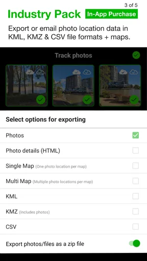
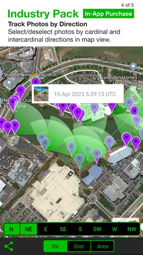
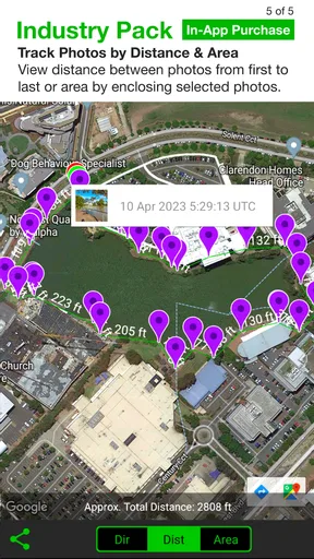
 Analysis by AppCompare
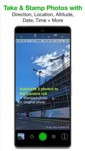
I found Solocator most useful when a photo needs to explain where and when it was taken, rather than simply look attractive. It is a photography app from Civi Corp that adds location, compass direction, and date/time information to pictures as I capture them. That makes it a practical tool for shared household tasks, travel planning, property notes, deliveries, outdoor projects, and any situation where a normal camera image leaves too much room for doubt.
My first impression was that this is a focused utility rather than a replacement for a phone’s main camera. It does one job with a clear purpose: turn an ordinary photograph into a visual record with useful context. The idea sounds simple, but the difference becomes obvious when several people need to coordinate around the same image. A photo of a damaged fence, a trail marker, a parked car, or a meter reading becomes easier to discuss when the direction and capture time are visible.
The app costs $0.99, carries an Everyone age rating, and has reached over 100 thousand installs. Its average rating is 3.7 from around 1 thousand ratings, so I would describe the reception as reasonably positive but not universally enthusiastic. It is currently at version 2.8.5 and requires Android 8.0 or later. There are also in-app purchases priced at $5.99 per item, which is worth keeping in mind before treating the low purchase price as the complete cost.
How it works in a shared household
A realistic example is a family preparing a house for maintenance. One person walks around taking pictures of a loose gutter, a cracked tile, and a damp patch near a window. Another person later needs to contact a contractor, but a regular gallery photo may not show which side of the house it came from or when it was captured. With Solocator, the image can carry the location, compass direction, and date/time directly on the photo, giving the second person more context without a long chain of messages.
I also see value when a shared device travels between household members. A parent might use the phone to record the condition of a rental property, then a partner might use it for a delivery or outdoor project. Because the information is stamped onto the image, the recipient does not need to open a separate map or remember what the photographer said. The picture itself becomes the handoff.
That convenience has a trade-off: the stamp is part of the visible photograph. This is helpful when the image is being used as evidence or a field note, but less attractive when I want a clean picture for a family album. I would use the app for documentation and keep the regular camera for portraits, food, events, and anything where an uncluttered frame matters more than location context.
One useful workflow is to separate “record” photos from “presentation” photos. I can take a Solocator image first to preserve the practical details, then use the normal camera for a cleaner image if the subject also deserves to be shared socially. This avoids forcing one photograph to serve two different purposes.
Worth Reading Before You Choose

EA SPORTS FC Mobile 26 Is a Bigger Football Game, but It Takes Time

Flipboard Shows What News Apps Must Do Beyond the Feed

Switching to Android Auto Means Rethinking Your Driving Routine

Google Calendar Makes a Crowded Week Easier to Manage

Ludo King Makes the Most of the Minutes Between Plans

Baby Panda World Brings Quick Play to Modern Phones, but Its Game Library Feels Busy
What the overlay adds in everyday use
The location stamp is the most obvious benefit, but the compass direction can be surprisingly useful. If I photograph several similar entrances, garden beds, roads, or walls, a direction marker helps distinguish them later. It is especially handy when reviewing images away from the original place, because “the west-facing wall” can be more meaningful than a vague memory of where I was standing.
The date/time detail is useful for progress tracking. For a household project, I could photograph the same area before work begins and again after it is finished. The visible timing helps organize the sequence without relying entirely on filenames or gallery sorting. It also makes the app suitable for documenting temporary conditions, such as a leak after rain or a delivery left at a particular location.
I would not treat the overlay as a substitute for careful notes. A photograph can show where and when it was taken, but it may not explain what changed, what needs to happen next, or who is responsible. For coordination, I still recommend adding a short message alongside the image, such as “replace this panel” or “check this corner tomorrow.” The app strengthens the visual record; it does not replace communication.
Setup boundaries before handing over the phone
Solocator is easiest to use when everyone agrees on what the images are for. Before giving a shared phone to another household member, I would decide whether the device is being used for private snapshots, property documentation, travel records, or a mixture of these. That simple boundary prevents confusion later, especially when the gallery contains images from several people and several locations.
Location-stamped photographs can reveal more than the person taking the picture may realize. A household should think carefully before sending them outside the family, particularly when an image identifies a home, a regular route, or a child’s usual destination. The app’s purpose depends on location information, so the benefit and the privacy consideration arrive together. I would review an image before forwarding it rather than assuming every photograph is harmless.
There is also an account-boundary issue. If several people use one device, the photos may naturally sit in the same camera roll, making it difficult to tell who created which record unless the household follows a naming or messaging routine. Solocator can add context to the image itself, but it does not turn a shared phone into separate personal workspaces. For a family that needs strict separation between users, a dedicated device or a clearer storage system may be a better solution.
My practical approach would be to create a simple habit: use the app only for clearly defined records, send each important image to the relevant conversation immediately, and remove duplicates from the shared gallery when the task is complete. That keeps the phone from becoming a confusing archive of unrelated stamped photos.
Coordinating trips, errands, and outdoor tasks
The app is a good fit for coordination because its information travels with the picture. Imagine one person scouting a campsite or walking through a large outdoor area while another person stays behind. A standard image may show the view, but a direction indicator can help explain which way the camera faced. When several photos are taken along a route, that extra orientation can make the sequence easier to reconstruct.
For errands, I could use it to record where a package was left, which entrance needs attention, or which parking area contains a vehicle. The visible time can help when several stops happen during the same outing. This is more useful than relying on memory, especially when another family member must continue the task later.
A less obvious use is comparing conditions from different visits. Suppose a household is monitoring a garden, a construction area, or a recurring drainage problem. Taking images from roughly consistent positions and paying attention to the compass direction makes the collection more orderly. The app does not automatically create a project report, so the discipline still comes from the user, but the stamped images provide a stronger foundation than loose camera photos.
For this kind of work, I would avoid taking dozens of nearly identical pictures. A small set of deliberate images is easier to review and share. One wide view for orientation, one closer view for detail, and one image showing the surrounding context is often more useful than a crowded gallery. The app makes each picture more informative, but it does not remove the need to choose the right viewpoint.
Age, trust, and the Everyone rating
The Everyone rating makes sense for the app’s basic purpose. There is no need for a child to understand advanced photography to take a location-marked picture, and a teenager could use it for a school project, a trip, or a practical household task. Still, an age rating is not the same as a family rule. Location information deserves an explanation before a younger user begins sharing these images.
I would show a child or younger teenager how to recognize the details visible on a stamped photo: the place, the direction, and the time. The important lesson is not simply “take the picture,” but “check what the picture reveals before sending it.” That is a useful digital habit whether the image comes from this app or any other location-aware tool.
Trust matters in a shared-device setting because the app creates records that may look authoritative. A photo with a location and time can feel definitive, even though the user still needs to frame the subject correctly and understand what the image proves. I would encourage children to ask before sharing images that show the home, school route, or another private place. For adults, the same principle applies when forwarding household documentation to contractors, neighbors, or group chats.
The low purchase price may make the app easy to add to a family device, but the extra in-app purchase price of $5.99 per item means I would check the purchase screen carefully before approving anything beyond the initial app purchase. On a shared phone, it is sensible for the device owner to handle purchases and explain which features are part of the basic installation and which may cost more.
Where it beats a normal camera, and where it does not
The usual phone camera wins for speed, image quality familiarity, editing flexibility, and clean composition. Everyone already knows how to open it, and the resulting pictures fit naturally into albums and social apps. If my goal is a polished family photo, I would choose the normal camera without hesitation.
Solocator wins when context is the point of the image. A regular camera may preserve location in the phone’s internal photo information, but that detail is not always visible to the person receiving the image, and it may be separated from the picture during sharing or export. A visible stamp is easier for a contractor, relative, or teammate to understand at a glance.
The trade-off is visual clutter and a more specialized workflow. The overlay can compete with the subject, and a stamped image may need cropping or separate handling before it is suitable for a presentation. I would not install this as my only camera unless nearly every photograph I take is a field record. For most people, it works better as a second camera for specific situations.
Compared with manually typing a location and time into a message, the app reduces the chance of mixing up several images. Compared with writing notes in a separate app, it keeps the key context attached to the visual record. Compared with a full project-management system, it is faster and lighter, but it does not provide the same structure for assignments, comments, or long-term task tracking.
Limitations I noticed in the decision process
The first limitation is that useful location information depends on the phone and the circumstances in which the photograph is taken. I would not assume that every image is equally reliable simply because a stamp appears on it. For important documentation, I would check the displayed details and make sure the scene itself is unmistakable.
The second is organization. Once a household has accumulated many stamped images, the app alone is unlikely to answer every question about ownership, status, or next steps. I would use folders, shared messages, or a consistent naming habit outside the capture moment. This is not a criticism of its focused design; it is simply the boundary between a camera utility and a complete records system.
The third is privacy. A clean-looking image can be shared casually, while a location-marked image invites more careful handling. If I am photographing a private residence or a child’s activity, I would think about the audience before sending it. In some situations, a normal camera followed by a private verbal explanation is the safer choice.
Finally, the app’s average rating of 3.7 suggests that the experience will not satisfy everyone equally. I would expect the best results from people who already know why they need visible location, direction, and time. Someone downloading it only because it sounds interesting may find the overlay unnecessary and the specialized workflow less convenient than the default camera.
Who should install it on a shared device?
I would recommend it to a household that regularly documents property issues, coordinates outdoor activities, records travel locations, or shares practical visual instructions. It is particularly useful when the person viewing the photo will not be standing in the same place and needs immediate context without asking several follow-up questions.
I would also consider it for an older child or teenager working on a location-based project, provided an adult explains the privacy implications and agrees on where the images may be shared. The Everyone rating supports broad accessibility, but responsible use still depends on supervision, trust, and clear household expectations.
I would skip it if the main goal is casual photography, portrait taking, or social sharing. The visible information can distract from the image, and the app adds little value when the location is already obvious or irrelevant. I would also look elsewhere if the household needs separate user profiles, formal task assignment, or a searchable project archive; this is a focused photography tool, not a family coordination platform.
For a shared phone, I would start with one small test: photograph a household object or outdoor feature, send the image to another member, and ask whether the location, direction, and time actually help them understand it. If the answer is yes, the app has a clear role. If the recipient still needs a long explanation, the household may benefit more from a normal camera plus better notes.
My household verdict
After using it as a practical camera rather than a general photo app, I see a clear reason to keep Solocator available. It turns a picture into a compact field note, which is valuable when family members share errands, maintain a home, travel together, or need to compare conditions over time. The developer, Civi Corp, has kept the concept focused, and the current version 2.8.5 remains relevant for people who want this kind of visible context.
I would not describe it as an essential camera for everyone. The $0.99 starting price is approachable, but the in-app purchases at $5.99 per item deserve attention, and the visible stamp will not suit every photograph. The app also asks users to think more carefully about privacy and shared-device organization than an ordinary camera does.
My recommendation is straightforward: install it when the question is “Where was this taken, which way was I facing, and when did it happen?” If the question is “How do I take the nicest-looking photo?” the phone’s standard camera is the better companion. For households that understand that distinction, Solocator is a useful documentation camera rather than a decorative photography extra.
In my experience, its strongest feature is not any single stamp but the way the three pieces of context work together. Location helps identify the place, direction helps identify the viewpoint, and date/time helps place the image in a sequence. Used deliberately, that combination can save explanations and prevent mix-ups. Used casually, it can make the gallery busier and expose details that should not be shared. That balance is the key to deciding whether this specialized photography app belongs on a shared family device.
Pros
- Adds GPS coordinates
- altitude
- date
- and time directly to photos.
- Useful for documenting construction
- inspections
- surveys
- and site visits.
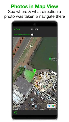
- Supports map
- compass
- and location details for better field context.
- Can help organize visual records without adding notes manually.
- Designed for quick evidence capture while working outdoors.
Cons
- Accurate results depend on a reliable GPS signal and location permissions.
- Location stamping can noticeably reduce battery life during extended fieldwork.
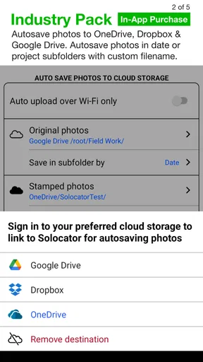
- Some advanced camera or export features may require a paid upgrade.
- Photos may reveal sensitive locations if shared without removing metadata.
- Outdoor readability can be difficult on the screen in strong sunlight.
FAQs for Solocator - GPS Field Camera
What is Solocator - GPS Field Camera used for?
Solocator - GPS Field Camera is designed to capture photos with useful location and field information overlaid directly on the image. Depending on your settings and device permissions, it can display GPS coordinates, address details, date, time, altitude, direction, and other location data. It is particularly useful for documenting inspections, construction progress, property visits, travel locations, outdoor activities, and evidence that needs clear geographic context.
Does Solocator require an internet connection to work?
The app can generally capture photos and record GPS-based information using your device’s location services, but some features may depend on internet access. Map data, reverse-geocoded addresses, satellite imagery, or online location details may not be available offline or could be less accurate. For reliable results, enable location services before taking photos and allow the app time to obtain a strong GPS signal, especially indoors or in areas with limited reception.
What permissions does Solocator need, and are they safe to grant?
Solocator typically needs access to your camera so it can take photographs, location services to add coordinates and related information, and possibly photo or storage access to save and manage captured images. These permissions are central to the app’s purpose, but you should review them carefully in your device settings. Grant only the access you are comfortable with, and remember that denying location permission can prevent GPS overlays from working correctly.
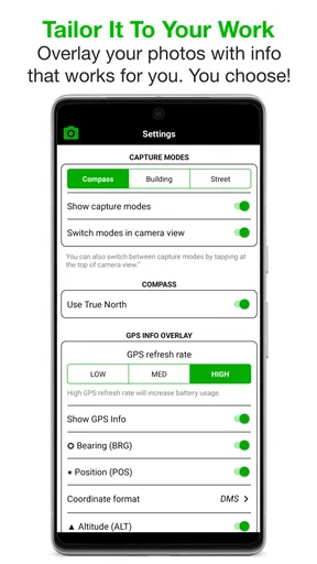
Can I customize the information displayed on Solocator photos?
One of Solocator’s practical advantages is the ability to configure the appearance and content of the camera overlay. Available options can include GPS coordinates, address, altitude, compass direction, date, time, notes, and other project-related details, depending on the app version and platform. Before using it professionally, test several layouts and confirm that the text remains readable without covering important parts of the image.
Are Solocator photos suitable for professional or legal documentation?
Solocator can be valuable for professional records because it places location and timing information visibly on the captured image, making photos easier to organize and understand. However, an overlay should not automatically be treated as independently verified legal evidence. GPS accuracy can vary, device settings may be changed, and images can be edited or shared. For legal, insurance, or compliance purposes, keep original files and follow your organization’s documentation requirements.


